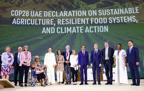
By Johnson Thembo Puruka
With the current water volumes of Lake Victoria locally known as Nalubale in the Central Uganda, standing at 14cubic meters, experts at Uganda National Meteorological Authority are warning that this volume, may be there to stay for some time.
The Lake Victoria basin has a drainage area of 183,000 square km, covering, Rwanda, Burundi, Uganda, Kenya, and Tanzania. The Lake is a source of River Nile, and it is fed by 23 rivers, of which Kagera that runs through Rwanda and Burundi is the largest.
80% of the Lake’s water is directly from rainfall and the amount of the regional rainfall, therefore regulates the amount of water in the lake.
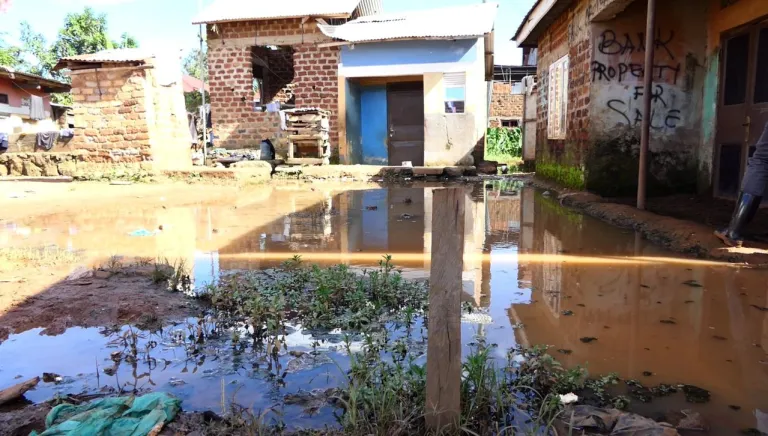
With the current variation in weather, leading to global warming, heat waves, and floods, areas around Lake Victoria and the catchment areas have greatly been affected by floods and landslides affecting humans and biodiversity. However, the worrying concern from the experts in weather forecasting department is that Uganda and the whole of East Africa will continue receiving these that fill up the lake.
George William Omony, the manager forecasting services at Uganda National Meteorological Authority says, basing on data collected by the Ministry of Environment and Water, in connection to Lake Victoria’s water levels, these are keeping on escalating in times of excess rains during the peak rain seasons.
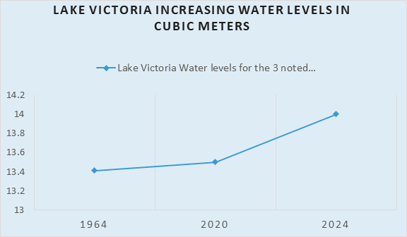
In 1964 Lake Victoria experienced a water swell up of 13.4 cubic meters, 2020 it measured to 13.50 – Looking at the trend, 2024 now stands to have registered the highest water volume. Omony, explains that, with such evidence, possibilities of ever having the water levels of this lake getting down, may be not be that fast. He adds that, with the depletion of the wetlands around Lake Victoria, whose responsibility is to accommodate the lake’s excess waters and managing the speed of water flow, areas within the Victoria basin are bound to continue suffering whenever this down warped lake swells up.